ASTM D2488 defines the standard for visual-manual classification of soils, and in Orlando that standard is not optional—it is the starting line. The city sits on a sequence of Pleistocene sands and silty clays draped over the Ocala Limestone, with karst dissolution features scattered across Orange County. Before any footing, retention system, or pavement section goes in, we open exploratory test pits to log the stratigraphy directly. No indirect inference. No waiting on lab turnaround for basic description. We log moisture, color, consistency, and structure on the spot, referencing the Unified Soil Classification System. When a pit exposes the contact between the surficial sand and the underlying stiff Hawthorn Group clay, the decision on bearing depth becomes immediate. For sites near the Wekiva River basin or in the Conway chain-of-lakes area, where groundwater can appear at less than 1.5 m depth, we often schedule a companion SPT drilling program to extend the investigation below the water table while the pit crew handles the vadose zone.
Direct visual logging in Orlando karst terrain catches dissolution features that borings alone can miss—one pit wall can save a foundation redesign.
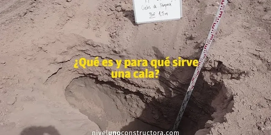
Method and coverage
Orlando's near-surface geology is dominated by fine to medium quartz sand with variable silt content, often underlain by stiff, overconsolidated clayey sand of the Hawthorn Group. Seasonal high water table can rise to within 0.6 m of grade during the June–September wet season. In a single pit, we document layer boundaries, seepage zones, root penetration, and any evidence of old sinkhole activity—colluvium pockets, clay seams with anomalous dip, or sudden loss of sand density. Our field logging follows ASTM D2488 and FDOT Section 455 earthwork guidelines: we record the in-situ density descriptor (very loose to very dense for sands; very soft to hard for clays), plasticity estimate, and Munsell color. When we encounter the limestone interface—typically between 2 and 8 m depth in the Orlando metro area—we measure rock quality designation (RQD) and fracture spacing directly on the pit face. This visual data feeds directly into bearing capacity calculations, pavement CBR estimates, and infiltration design for stormwater BMPs.
The pit cross-section can also serve as a calibration reference for the
MASW survey when we map shear-wave velocity profiles on the same parcel, tying Vs values to visually confirmed stratigraphy.
Regional considerations
Central Florida's wet-dry seasonal swing creates a predictable risk for test pit investigations: collapse. A pit wall that stands vertical in April can slough after a single afternoon thunderstorm in July. The upper 1–2 m of Orlando's sandy soils lose apparent cohesion as moisture content rises, and OSHA Type C soil classification becomes the default during the rainy months. We bench, slope, or shore every excavation according to 29 CFR 1926 Subpart P, and no one enters a pit deeper than 1.2 m without a competent person sign-off. Sinkhole proximity is the second risk driver. If the pit exposes a clay layer with erratic thickness or a sand-filled chimney descending into the limestone, we flag it immediately—these are the signatures of raveling and cover subsidence, the dominant sinkhole mechanisms in Orange and Seminole counties. Overlooking them during a test pit program leaves a latent defect that no amount of compaction grouting later can fully erase.
Top questions
What depth do you typically reach with a test pit in Orlando?
Most pits in the Orlando metro go to 2.4–3.6 m with a compact excavator. When we need to expose the limestone contact for bearing verification, we can reach 5–6 m with a mid-size machine, provided the site has adequate access. Deeper than that usually shifts the investigation to SPT drilling.
How much does an exploratory test pit cost in the Orlando area?
A single pit with full ASTM D2488 logging, site plan markup, and a summary letter typically runs between US$470 and US$760, depending on depth, access, and whether we need to bring in a larger excavator. Multi-pit programs for commercial sites are quoted by the day.
How do you handle groundwater seepage in the pit?
We measure and record the depth at which seepage appears and note the rate. If water accumulates faster than a small sump pump can handle, we may stabilize the pit with a gravel bench and schedule a follow-up SPT boring at that location to extend the investigation below the water table.
Can a test pit confirm whether my lot has sinkhole activity?
A test pit can reveal several direct indicators: raveling zones (sand pipes descending into limestone), abrupt clay thinning, tilted limestone blocks, or organic-stained sand at depth. If we see these features, the report flags them clearly, and we typically recommend geophysical follow-up to map the lateral extent.
What backfill material do you use after the pit is logged?
We backfill with the excavated material placed in lifts and compacted with a plate compactor or jumping jack, matching the surrounding density. If the pit is within a future building footprint, we can use a controlled low-strength material or flowable fill to eliminate settlement risk under the slab.